
P3D Topo
$1,750.00
Bridge the gap between drones and CAD
Designed for use by surveyors, civil engineers, and contractors, Precision 3D Topo allows users to import survey data, points, polylines, surfaces, point clouds, both traditional LIDAR and aerial drone survey data, and more from a wide variety of programs and entities to create usable 3D surfaces.
• Importing Point Cloud data from Lidar and Aerial Drone mapping.
• Merge and edit point clouds to create surface models.
• Import survey data to further refine surface models.
• Powerful surface Editing tools to perfect surface models. Including Google Maps photographic background, automated Google surface creation.
• Easy surface volume tools directly from point clouds or surfaces.
• Advanced Texturing and Presentation Tools
• Import / Export all data as LandXML, DXF, and Surface Models as TIN, TN3, and TTM.
See Available Discounts in Cart
Features
Carlson Precision 3D Topo
Carlson P3D Topo is designed for surveyors, civil engineers and contractors to easily combine data from a wide variety of sources, including survey data, points, polylines, surfaces, point clouds and LiDAR (traditional and UAV), to create high-fidelity 3D surfaces. Fast point cloud editing lets you reduce the size of a point cloud and still keep an accurate surface, and you can view large areas, merge overlapping point clouds, crop to the area you need and import other spatial data formats.
Surface creation
- Create surfaces from point cloud data, with no reduction for the highest resolution, grid reduction for faster loading of large surfaces, or simplification
- Create surfaces from imported points and polylines
- Add points and breakline polylines to existing surfaces
- Crop and merge surfaces
Surface editing
- Real-time surface editing with dynamic contours
- Unified calculate volumes command, including surface-to-surface volumes; cut/fill volumes shown in the properties window
- Add or remove points, add breaklines, swap triangle edges, remove triangles
- Edit point elevations or set them from a slope
- Surface smoothing, improve ridges and valleys, remove dimples
- Create PAD template surfaces for cut and fill
- Simple texturing using polylines, crop surfaces to a polyline, merge surfaces
Point cloud tools
- Remove trees, vegetation, cars and buildings with the bare-ground filter, including within polygon boundaries
- Point selector tool to delete and crop, with the option to create a new cloud from the selection
- Copy point cloud regions inside polygons; merge, crop and delete point clouds
- Reduce points with smart voxel grid, outlier and shadow-point filters
- Save point clouds to LAS/LAZ 1.2, 1.3 and 1.4, including the coordinate projection
- Uses multiple CPU cores for faster performance
Screenshots
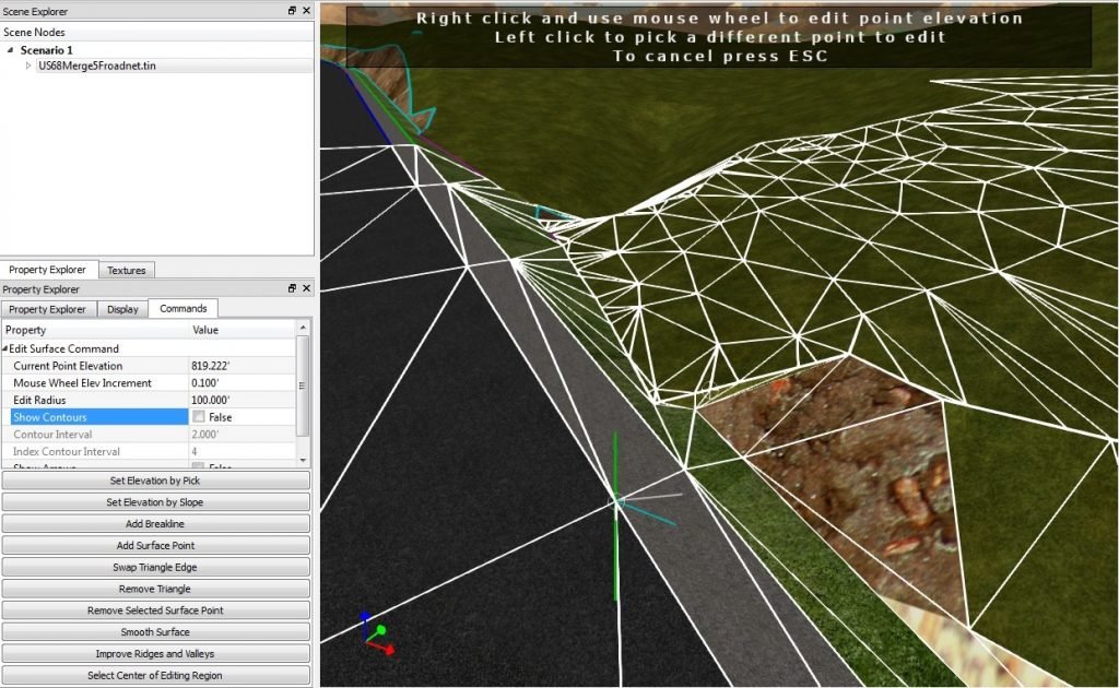
DTM Editing
P3D Topo’s editing ability of digital terrain models (DTMs) offers many benefits:
- Load and review the two most common formats for surfaces: LandXML and DXF files of 3D Faces, in addition to TIN and Grd files from Carlson Software.
- Overlay other LandXML file types such as points, alignments, parcels, storm and sanitary sewers, culvert pipes and other piping systems.
- View the 3D Surface with user-controlled textures to quickly spot errors in the DTM.
Fix the errors in the DTM for re-saving and use in CAD programs, or for direct output for machine control and survey stakeout.
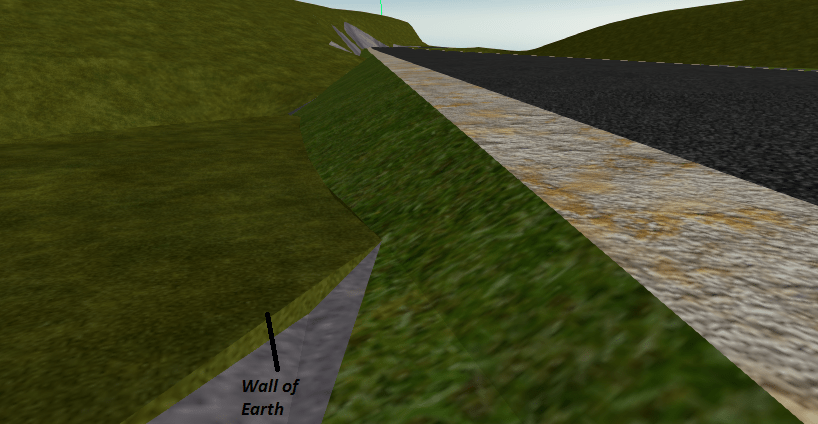
Never before has there been such an array of tools to locate and correct DTM errors, all in a sharp 3D interface. Surveyors, contractors and engineers alike can use the software to make sure the final DTM surface is of the highest quality. Editing tools include surface blending, spike and dimple removal, DTM vertex editing and surface pad placement by defined polygon and outslope conditions. Multiple undoes and redoes allow you to study your changes and makes things perfect.
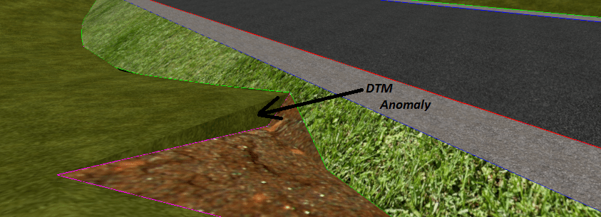
Use the automated color and texture contrasts of P3D Topo to find DTM Anomalies and then remove them with routines such as blend.
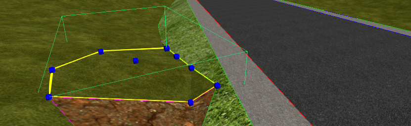
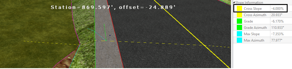
Inspection tools include slope analysis at any point, referencing any selected or drawn alignment. The slope analysis below shows a grade of 4.000% at the selected point but also a profile slope of 6.170% along the alignment and a maximum slope of 7.353%. Any edited or existing slope can be carefully examined for accuracy in terms of fulfilling the intention of the design.
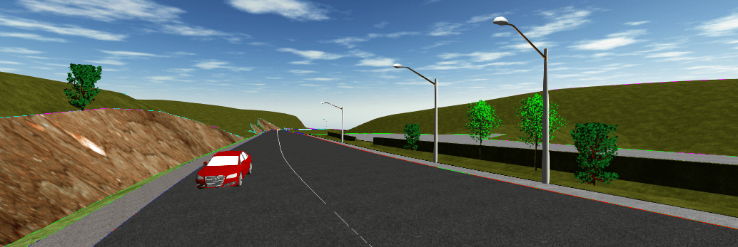
In addition, P3D Topo will allow placement of symbols from a user-expandable symbol library, and will even conduct automated field-to-finish, in 3D, from points and descriptions, leading to realistic site renderings.
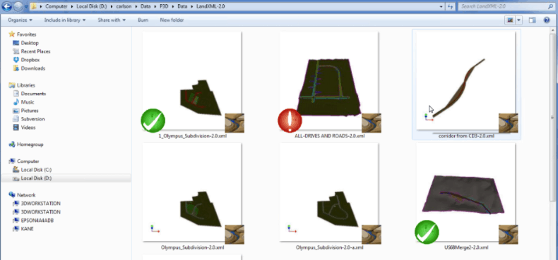
Study all your DTM surfaces by taking advantage of the thumbnail viewer. Look through your files and quickly track to the target file. Load it, study it, and perfect it.
Modified surface data can be exported to LandXML-2.0, Carlson TIN, Trimble TTM, Topcon TN3 and 3D printer as STL. Yes, you can even use 3D printing to make models of your final designs, ready to show to planning commissions and to impress the project funding team. P3D Topo is the ultimate 3D visualization and editing tool all wrapped up in one solution. If DTM errors have been found and fixed, if slopes have been studied and validated, and finally, if it looks good, then it IS good. It’s ready to build, ready to show or ready to use for final design work. If you are in the DTM business, you need Precision 3D Topo.
Remarkably Easy-To-Use 3D Engineering Design Software
- P3D is multithreaded and performance will increase with core count.
- P3D is 64bit and will use all available RAM available to support large models.
- P3D uses advanced 3D shaders and performance will increase with graphics cards that process these faster.
Videos
System Requirements
For Carlson’s CAD-based products
Carlson products installed on top of IntelliCAD or AutoCAD are subject to the same requirements as the CAD engine itself. Please follow the requirements for your CAD platform below and allow an additional 750 MB of hard-drive space for the Carlson application.
IntelliCAD (included)
Carlson 2027 runs on IntelliCAD 14.1, with IntelliCAD 13.1 also provided for legacy compatibility.
- Compatible with 64-bit Windows 8.1, 10 and 11
Hardware
Intel® i9, i7 or at least i5, AMD Ryzen 7/9, or comparable processors are recommended. Due to the variety of processors on the market, you can use cpubenchmark.net/cpu_list.php to compare them. While the overall processor score matters, single-thread performance is of the most interest.
- 64-bit Windows 8-11: 8 GB of RAM minimum, 16+ GB recommended
Graphics card compatible with OpenGL version 1.4 or higher:
- Discrete desktop-level graphics cards are recommended (not integrated graphics such as Intel HD)
- Nvidia is preferred due to more consistent driver support
- Discrete AMD cards are adequate, but AMD driver support has been spotty and users are often referred to the computer manufacturer for support
- High-end graphics cards are not required apart from demanding actions in Carlson Point Cloud. Gaming cards often provide better value than workstation cards, and more memory or a better CPU will generally help more than a high-end graphics card
Learn more about IntelliCAD.
Embedded AutoCAD® OEM engine
Carlson Survey OEM 2026 (AutoCAD 2026 embedded)
- 64-bit Microsoft® Windows 11 and 10
- Basic: 2.5-2.9 GHz processor with 8 logical cores; recommended: 3+ GHz processor
- 8 GB RAM (minimum), 16 GB (recommended)
- 10 GB free disk space for installation (SSD suggested)
- 1920 x 1080 monitor; resolutions up to 3840 x 2160 supported
- Display card with 2 GB GPU memory, 29 GB/s bandwidth and DirectX 11 compliance; 8 GB GPU memory with 106 GB/s bandwidth and DirectX 12 recommended
Carlson Takeoff R13 (AutoCAD 2022 embedded)
- 64-bit Microsoft® Windows 11 and 10
- Basic: 2.5-2.9 GHz processor; recommended: 3+ GHz processor
- 8 GB RAM (minimum), 16 GB (recommended)
- 10 GB free disk space for installation
- 1920 x 1080 monitor; resolutions up to 3840 x 2160 supported
- Display card with 1 GB GPU memory, 29 GB/s bandwidth and DirectX 11 compliance; 4 GB GPU memory with 106 GB/s bandwidth and DirectX 12 recommended
- Install from download
AutoCAD® purchased separately
Carlson 2027 is compatible with AutoCAD® 2027. Please see the AutoCAD system requirements for specifications, which are subject to change without advance notice. See above for the hard-disk space needed for the Carlson application.
PhotoCapture Standalone
| Hardware | Minimum | Recommended |
| CPU | Intel i9 / AMD Ryzen 7 | Intel i9 14th gen / AMD Ryzen 9 |
| CPU cores | 8 / 8 | 24 / 16 |
| CPU threads | 16 / 16 | 32 / 32 |
| RAM | 32 GB | 64 GB or more |
| NVMe SSD | 1 TB free | 2 TB or more free |
| Graphics card | Nvidia GeForce* | Nvidia GeForce* |
* PhotoCapture does not use the GPU, but Nvidia GeForce series cards are recommended for other Carlson Software products.
Free Support
Carlson Software Works For You
A customer’s relationship with Carlson Software goes beyond simply purchasing our software – with Regional Managers throughout the country, free technical support for life, and training options for any budget – we’ve got you covered!
Carlson Software Direct Technical Support
- Hours: Monday – Friday, 8:00 AM – 6:00 PM (EST)
- E-mail: moc.wsnoslrac@troppus
- Problems/Suggestions: Send in a report
- Telephone: 606-564-5028
- Fax: 606-564-6422